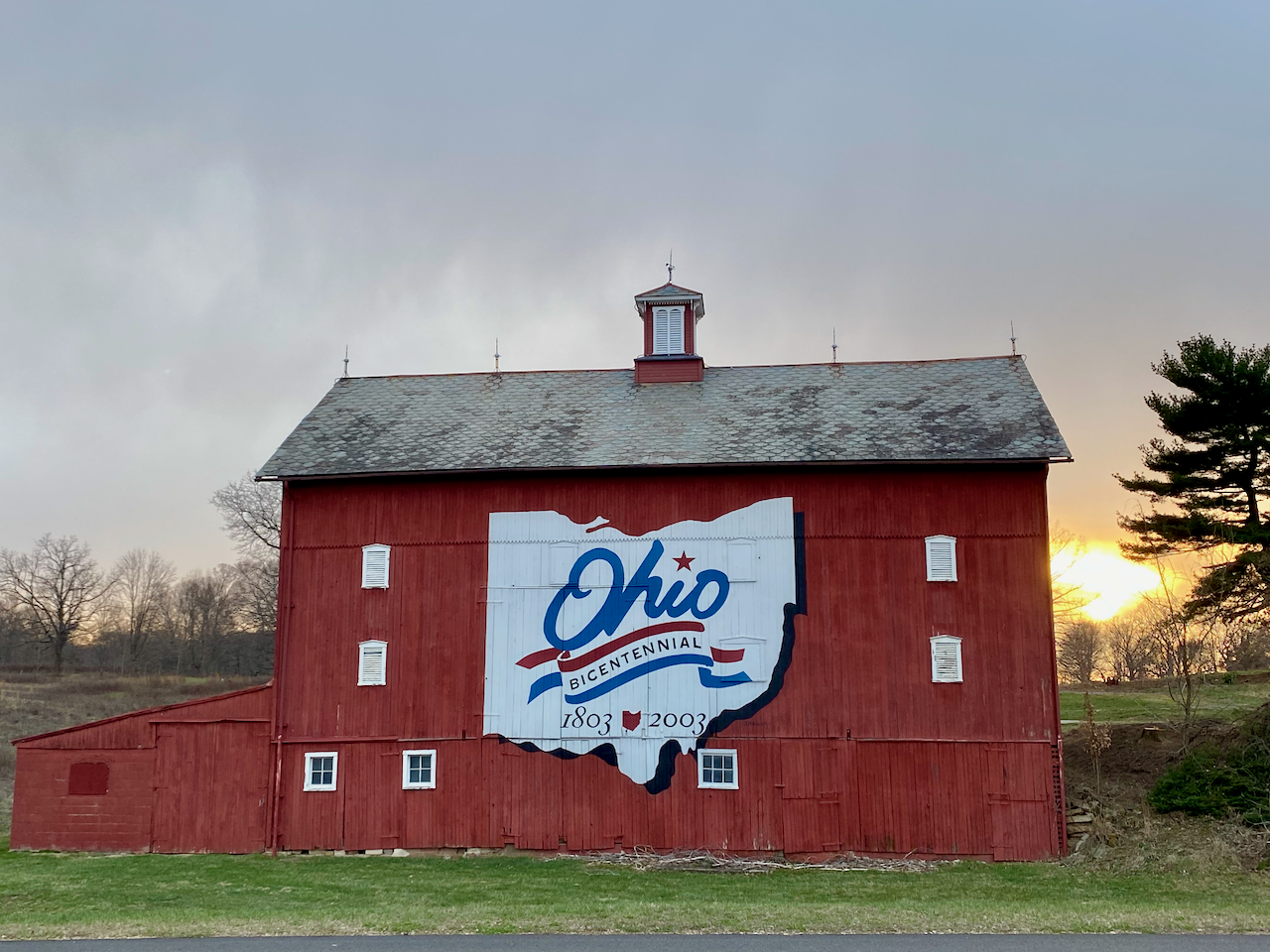
Barns visited so far: 43/88
- missing the Logo: 8
- gone: 6
Adams County
Where to view and visit: 6620 Ohio Route 136, West Union, at 38.77536, -83.59925
Ashland County (no logo)
Where to view: north-bound i71, after passing under County Road 995
Where to visit: 974 County Road 1600, Ashland
Ashtabula County
Where to view: south-bound Ohio Route 11, before the Ohio Route 307 (Dorset Road) exit, at 41.70703, -80.71027 — there is a wide spot at the exit ramp for Dorset Road (Ohio 307) where it reasonably safe to stop for a photo.
Where to visit: 1648 Overly Road in Jefferson; west of Ohio Route 11
Auglaize County
Where to view: north-bound i75, at 40.60383, -84.15532, or 17424 County Road 25A, Wapakoneta. It’s also possible to get a glimpse from the entrance ramp to the south-bound rest stop.
Where to visit: 15618 Hengstler Road, Wapakoneta
Brown County
Where to view and visit: 6538 US 52, Ripley is a used car lot that could be used to stop briefly. The Barn faces south across US 52 and there is a private drive leading up the hill to the Barn from this address (38.72406, -83.82971)
Clark County (no logo)
Where to view and visit: 6880 Springfield-Xenia Rd, north of Yellow Springs (39.82914° N, 83.86980° W)
Clermont County (no logo, now Semiquincentennial)
Where to view: west-bound Ohio Route 32, east of the McKeever crossing a bit (39.06534, -84.04697)
Where to visit: 4268 McKeever Pike, Williamsburg
Clinton County
Where to visit (and view): 901 New Oglesbee Road, Wilmington (39.50769° N, 83.88357° W)
Where to view: South-bound i71, past the US 68 exit, and past Gurneyville Road (39.50621° N, 83.88286° W)
There is not a safe spot on i71 to stop and take this Barn’s picture.
Columbiana County
Rt 45 about 3 miles north of Lisbon
Latitude: N40 49.06 Longitude: W80 47.92
Coshocton County
Where to see and visit: 54210 US 36, Fresno (40.29429° N, 81.74177° W)
Crawford County (gone)
Where to view and visit: 3536 Ohio Route 598, Crestline, about 1.5 miles north of U.S. 30 (40.83346, -82.78757)
Cuyahoga County
7450 West 130th in Middleburg Heights south of Bagley Road
Latitude: 41.36228, Longitude: -81.78493
Delaware County
Where to view and visit: 6844 Bale Kenyon Road, Lewis Center (40.17054, -82.96183)
There is a parking lot at the church across the street that could be used to stop briefly.
Where to view: south-bound i71, some miles south of the rest area approaching Columbus and before the Ikea exit
Erie County
3707 Perkins Ave, outside Huron
Latitude: 41.42033, Longitude: -82.63756
Fayette County (gone)
Nothing to visit or see here: 8473 Ohio Route 41, north of Washington Court House (39.62343° N, 83.52997° W)
Geauga County
Where to view and visit: 13034 Madison Road, south of US 322 and north of Middlefield. There is a private drive leading from Madison Road to the Barn, but be careful to not block the owners’ traffic into and out of their property (41.51564, -81.05171).
Greene County
Where to view and visit: 3630 US Route 42, east of Centerville (39.76253° N, 83.79014° W)
There’s a second entrance at 2990 Fishworm Road
Hamilton County
Where to view and visit: 7941 East Miami River Road, at 39.23748° N, 84.70297° W and there’s plenty of room in front of the Barn for stopping.
Harrison County
US 250 west of Rt 22 by 1.8 miles.
Latitude: 40.29188, Longitude: -81.03723
Highland County (no logo)
3099 Ohio Route 62 South of Hillsboro
Latitude: 39.09454, Longitude: -83.68004
Holmes County
7260 SR 83, just south of Holmesville
Latitude: 40.61295, Longitude -81.91554
Huron County
In Olena, about 10 miles southeast of Norwalk, near 479 U.S. Rt 250
Latitude: 41.15226, Longitude: -82.53873
Huron County Extra
In Lyme Village, east of Bellevue on Rt 113 near Rt 4
Latitude: N41º 16.84′ Longitude: W82º 47.41′
Lake County
Where to view: 8249 Munson Road, Mentor (north of Ohio Route 2 by mile and a quarter), at 41.70314, -81.34466
Where to visit: There’s a small church just to the west of the Barn (on the same side) and it might be possible to stop there to visit the Barn.
Lorain County (no logo)
Where to view and visit: 9455 Leavitt Road (Ohio Route 58), Elyria (south of Rt 113) at 41.35374, -82.21313 and there’s plenty of room in front of the Barn for stopping.
Lucas County (gone)
Where to view and visit: 1625 South Crissey Road in Monclava (41.60834, -83.76142).
The Crissey Road Food & Beverage Center across the road has parking.
Lucas County Extra
There’s a Barn in the north of Lucas County with a Bicentennial Logo that doesn’t appear to be one of the original 88.
Where to visit and view: 12155 Sylvania-Metamora Road in Berkey (41.71516, -83.83640). There is a private drive leading from the road to the Barn, but be careful to not block the owners’ traffic into and out of their property.
Madison County (gone)
Where to view: South-bound i71 (39.73120° N, 83.36921° W)
There is not a safe spot on i71 to stop and take a picture.
Where to visit: 5398 Bethel Road, Mount Sterling
Mahoning County
Where to view: east-bound i76, after crossing under the Tippecanoe Road bridge (41.01098, -80.70716)
Where to visit: 7435 Tippecanoe Road in Canfield (41.01056, -80.71128). There is a private drive leading from the road to the Barn, but be careful to not block the owners’ traffic into and out of their property.
Medina County (no logo)
Where to view: north-bound i71, past the i76/US 224 interchange (approximately 41.04037, -81.87545)
There is not a safe spot on i71 to stop and take this Barn’s picture.
Where to visit: 8354 Wooster Pike Road, Seville (41.04515, -81.86439)
There is a utility location south of this Barn that makes a safe place to stop temporarily.
Medina County Extra
710 West Smith Road, Medina; at the Fairgrounds
Latitude: 41.13326, Longitude: -81.88026
Mercer County (gone)
Where to view and visit: 7619 US-127, Celina; north of Route 197 by 1.2 miles (40.57073, -84.57116)
Montgomery County
Where to view: Northeast of Dayton, along i70 west, about 1 mile west of SR 235 exit #41 (39.86651° N, 84.07717° W)
There is not a safe spot on i70 to stop and take this Barn’s picture.
Where to visit: 8120 Bellefontaine Road, Dayton
Ottawa County
15721 SR-2, Oak Harbor; Ohio Route 2 west of Route 590 intersection by .7 mile
Latitude: 41.60405, Longitude: -83.23608
Pickaway County (gone)
Nothing to visit or see here: 5658 US Route 22, Circleville (39.58590° N, 83.05865° W)
Pike County
Where to view and visit: northeast corner of Ohio Route 104 and Ohio Routes 1124/32 (Appalachian Highway) in Jasper, at 39.04780, -83.05137
Portage County (no logo)
6205 Tallmadge Road, Rootstown; west of Rt 14 by about a mile
Latitude: 41.09900, Longitude: -81.16932
Ross County
Where to see and visit: 5287 US 23, south of Chillicothe (39.25162° N, 82.98011° W)
Sandusky County (no logo)
Where to view and visit: 901 Rawson Street, Fremont, in the Sandusky County Fairgrounds, (41.35841° N, 83.11613° W)
Scioto County
Where to view: 8844 Ohio Route 335, in Minford (38.85974° N, 82.85829° W)
Where to visit: 10926 Ohio Route 139 (38.86000° N, 82.85733° W)
Seneca County
7595 West SR 12, five miles northeast of Fostoria.
Latitude: N41 12.36 Longitude: W83 19.36
Summit County
3742 Hudson Drive. Visible from Rt 8 just north of Silver Lake exit
Latitude: 41.17110, Longitude: -81.47848
Trumbull County
7763 East Liberty Street, Hubbard; west of the PA state line by 1 mile
Latitude: 41.16611, Longitude: -80.53684
Warren County
Where to view and visit: 6012 Ohio Route 48, Lebanon, at 39.52230° N, 84.18120° W
Wayne County
Where to view and visit: 6500 Ashland Road, Wooster, on US 250, about 6 miles west of Wooster, at 40.82022° N, 82.05225° W
Wayne County Extra (gone)
Nothing to visit or see here: 459 S Hillcrest Drive, Wooster; near the property of Cat’s Meow (40.79184° N, 81.90539° W)
Wood County
Where to view: east-bound i80/i90 (south side), about 1.5 miles east of i280 (41.51736, -83.44099)
There is not a safe spot on i80/i90 to stop and take this Barn’s picture.
Where to visit: 2416 Ohio Route 163 (Genoa Road), just east of Stony Ridge. There is a private drive leading from Genoa to the Barn, but be careful to not block the owners’ access into and out of their property (41.51487, -83.44113).